Between 4 and 6 PM EDT on Saturday July 24, 2010, four
tornadoes touched down in the Southern Tier of Western NY. The first went through Mayville
at around 4:40 p.m., crossed the Chautauqua Lake, and moved through Dewittville,
while a second touched down and went through Randolph around 5:25 p.m. These two tornadoes caused significant damage
and were rated EF2. A third but weaker
EF1 tornado touched down in Great Valley at around 5:25 p.m.. The fourth tornado was rated an EF1 and moved
through the town of Carrollton and into the village of Allegany at around 5:50
p.m.
Between 4 and 6 PM EDT on Saturday July 24, 2010, four
tornadoes touched down in the Southern Tier of Western NY. The first went through Mayville
at around 4:40 p.m., crossed the Chautauqua Lake, and moved through Dewittville,
while a second touched down and went through Randolph around 5:25 p.m. These two tornadoes caused significant damage
and were rated EF2. A third but weaker
EF1 tornado touched down in Great Valley at around 5:25 p.m.. The fourth tornado was rated an EF1 and moved
through the town of Carrollton and into the village of Allegany at around 5:50
p.m. 
METEOROLOGICAL BACKGROUND
Western NY was under what is commonly referred to as the
warm sector, the area between a warm and cold front. The air mass over the region was unusually
moist, with dewpoints in the lower to mid 70s.
In fact, as we moved into the warm sector on the previous day, the
precipitable water rose to 2.26 inches, one of the highest readings over a 50
year period. By Saturday morning, a
significant area of dry and warmer air aloft had worked its way into the
region, dropping the precipitable water down to a more tolerable 1.41 inches.
The air mass near the ground retained a high level of moisture. Even with the
warmer air in place aloft, we were still unstable at the start of the day. A significant amount of cloud cover
prevented storms from quickly forming though and temperatures, already in the
mid 70s in the morning, were slow to rise.
By mid afternoon, a bit of clearing allowed temperatures to rise into
the lower 80s, increasing instability.
Meteorologists often refer to three key “ingredients” needed
for thunderstorm development: moisture,
instability, and lift. For tornadic
storms, you need an additional ingredient called directional wind shear. It is clear that there was plenty of moisture
as noted above with high dewpoints in the area.
We also had plenty of instability.
The lifting mechanism came in the form of a dying Mesoscale Convective
System (MCS) over Southern MI, that left what is known as a Mesoscale
Convective Vortex (MCV) spinning quietly away as it crossed into Lake Erie. The origins of the MCS and
eventual MCV can be traced back to Iowa Friday night. The MCV provided both the lift and
directional shear needed for a tornadic event.
Between 12 and 3 p.m. the vortex with a broad area of
rotation in the atmosphere can be seen clearly on both the Detroit
and Cleveland NWS WSR-88D radars. There was little thunderstorm development
with this feature until after 3 p.m., when a line of thunderstorms developed on
the back side of the MCV. This line continued to rapidly intensify as it moved
across the lake while other storms formed out ahead of the main line. These storms quickly began rotating, that is,
they developed into supercells.
Individual supercells commonly form out ahead of a squall line in the
Midwest and are sometimes tornado producers.
As the line approached these storms, their rotation increased, as seen
in the storm relative motion depicted by NWS BUF WSR-88D. While the radar cannot directly pick out a
tornado, a trained meteorologist can infer strong rotating updrafts and storm
structures from the radar that typically produce tornadoes. In this case, the forecaster first issued a
Severe Thunderstorm Warning at 3:41 p.m., then upgraded the warning to a Tornado
Warning at 4:08 p.m. (This resulted in a
lead time of about 30 minutes.
Typical lead times across the NWS are about 15 minutes.)

At one point there were three prominent areas of rotation
over Chautauqua County, although only one of those radar signatures produced a
tornado in that county. The
first area of rotation didn't produce a tornado until it moved over Great
Valley, in Cattaraugus County. The
second area of rotation never produced a tornado. The trailing area of rotation was responsible
for three tornadoes, with the first touchdown near Mayville and Dewittville,
then again over Randolph, and finally over the Village of Allegany. The radar showed several other areas of
rotation over both NY and PA, although only one other tornado was reported (in
Galeton, PA (Potter County).
DAMAGE SURVEY
The NWS conducts a thorough damage survey of significant severe storms. For tornadoes, the NWS looks at damage and assign a rating as defined by the new Enhanced Fujita Scale, which looks at a number of damage indicators (ex homes, trees, mobile homes, schools etc), and then looks at the degree of damage for each case, and then assigns a lower and upper bound wind speed. Once the survey is completed, an EF rating is assigned to the tornado.
Here are some of the images taken by NWS personnel during the storm surveys of the areas affected by the tornadoes on July 24, 2010 (Figures 8-20).
| |
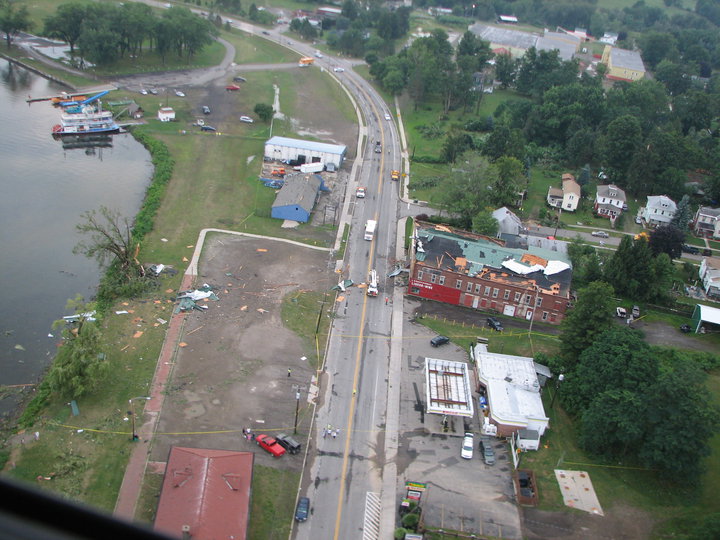
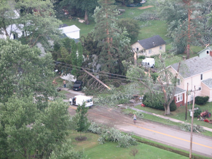 Figure 10: NWS storm survey - Mayville - Residential damage...downtown Mayville. | 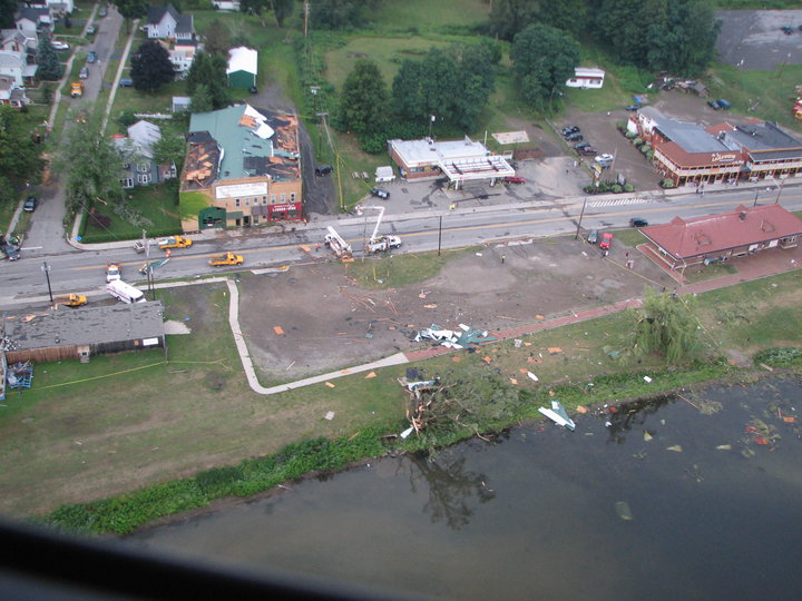 Figure 11: NWS storm survey - Mayville - Another angle of the damage path heading out across Chautauqua Lake. |
| 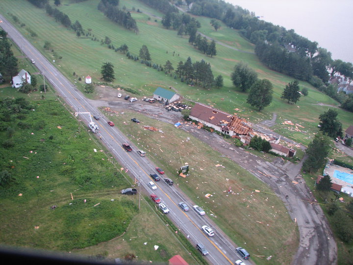 Figure 13: NWS storm survey - Mayville - Major EF2 damage to these structures in Dewittville...across Chautauqua Lake from Mayville. |
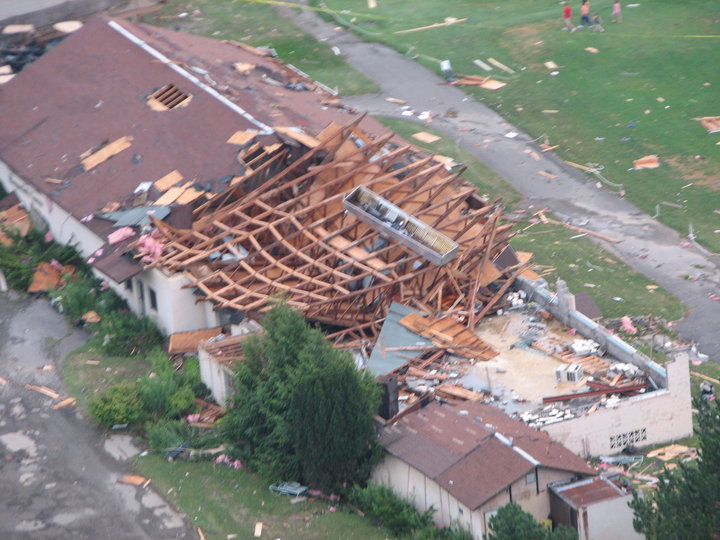 Figure 14: NWS storm survey - Mayville - Almost complete destruction to this building in Dewittville. | 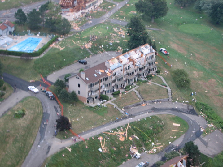 Figure 15: NWS storm survey - Mayville - Condos on the Chautauqua Lake shore line that lost the majority of its roof. Not visible in this photo, but a kayak from the lake was thrown into one of these condo units. |
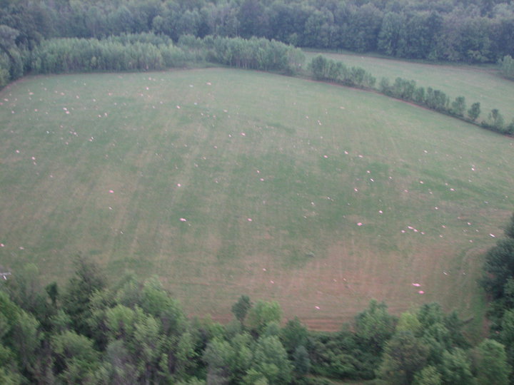
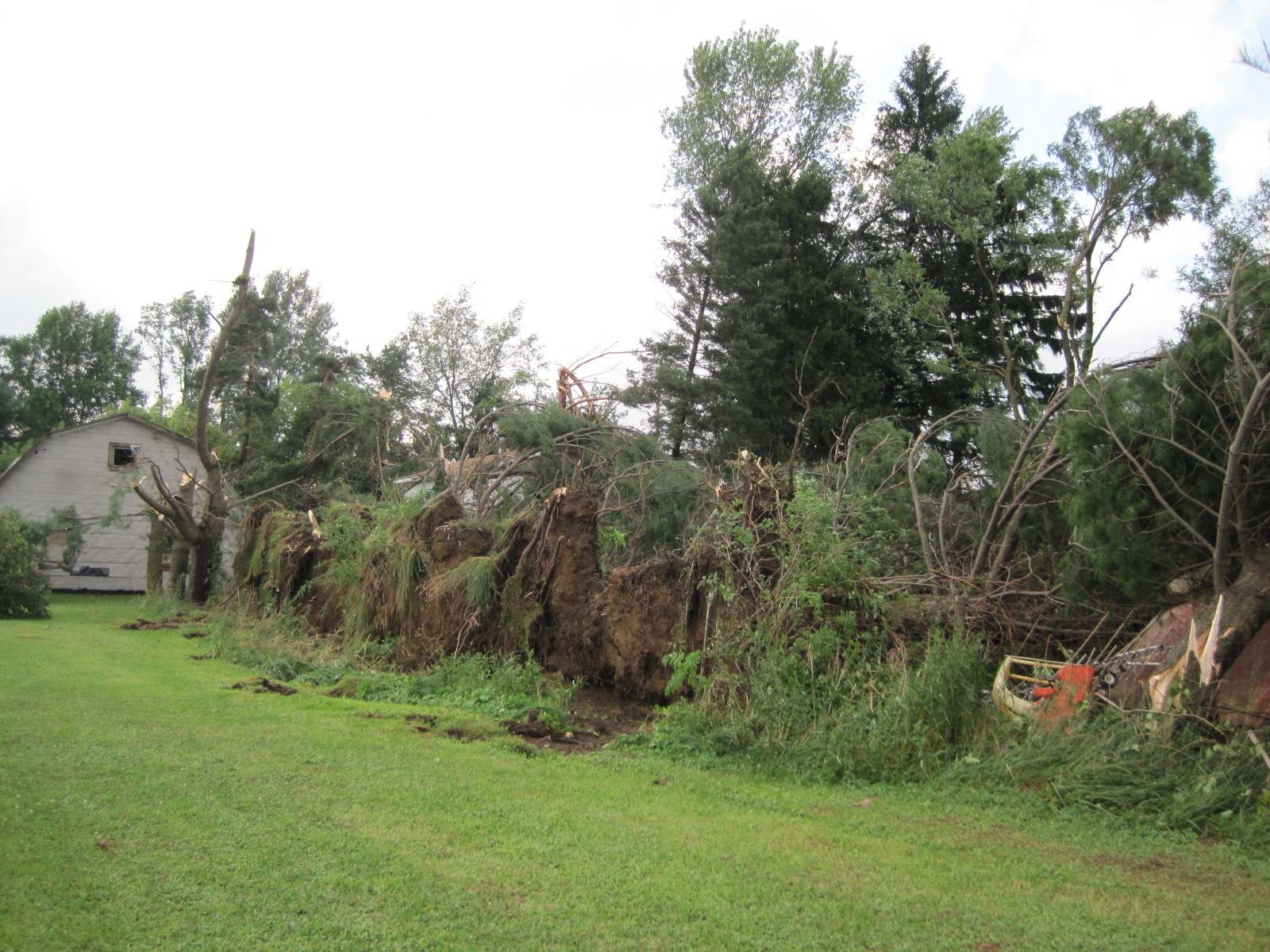 Figure 16: NWS storm survey - Mayville - Multiple trees down in a row with topped trees in the background. | 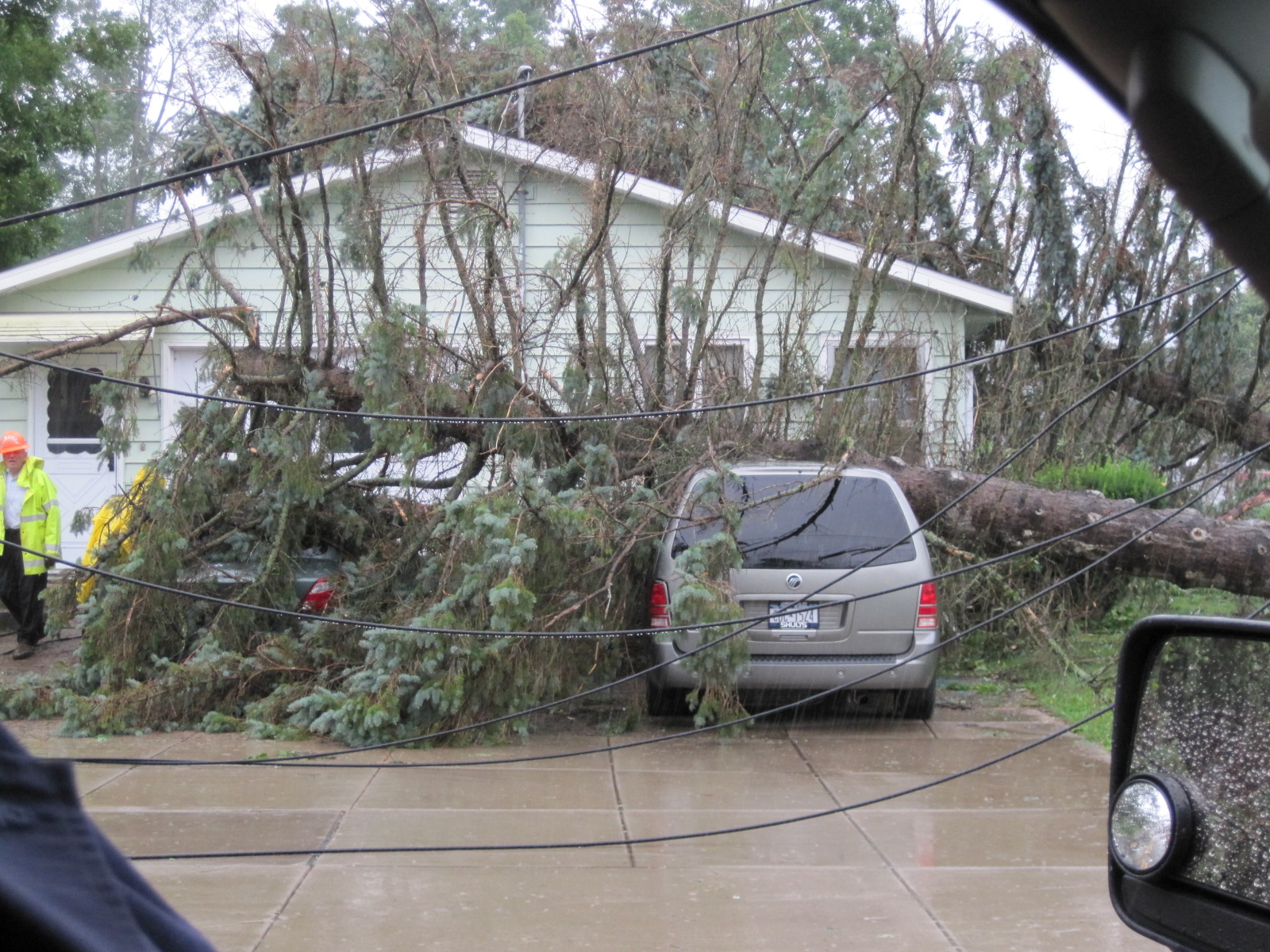 Figure 17: NWS storm survey - Randolph - Tree on care with nearby wires down. |
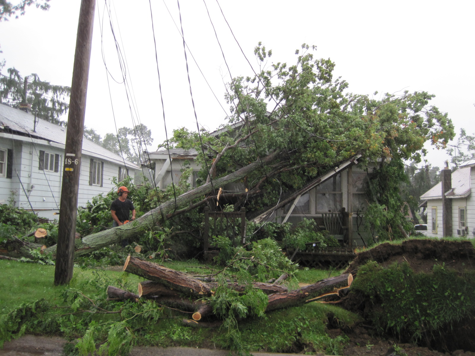 Figure 18: NWS storm survey - Randolph - Damage to area homes from fallen trees. | 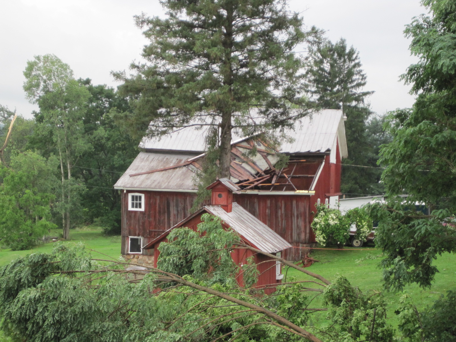 Figure 19: NWS storm survey - Randolph - Barn roof lifted off with multiple trees downed or topped in the area. |
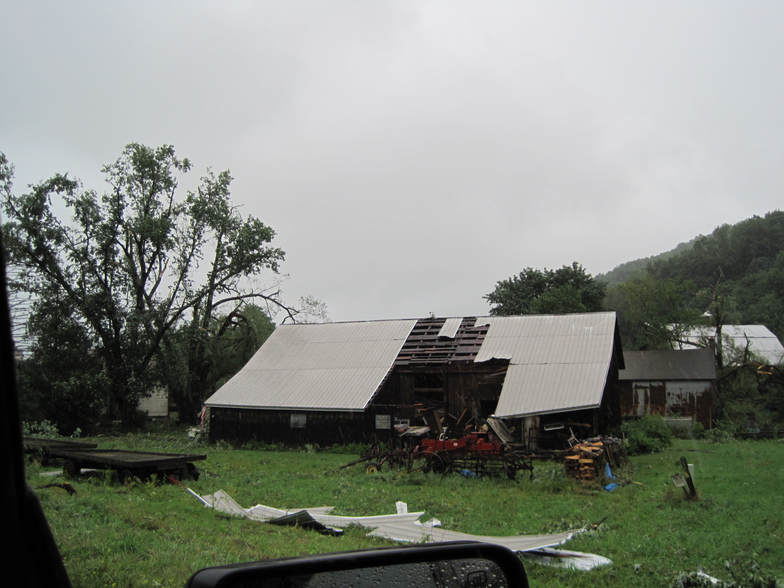 Figure 20: NWS storm survey - Randolph - Barn roof lifted off. |